A Visual and Verbal Narrative of Arizona's Salt River
Menu
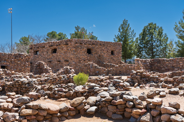
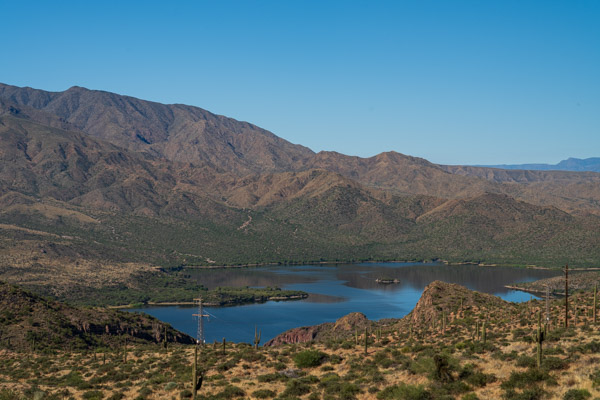
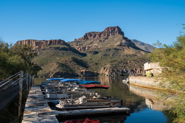
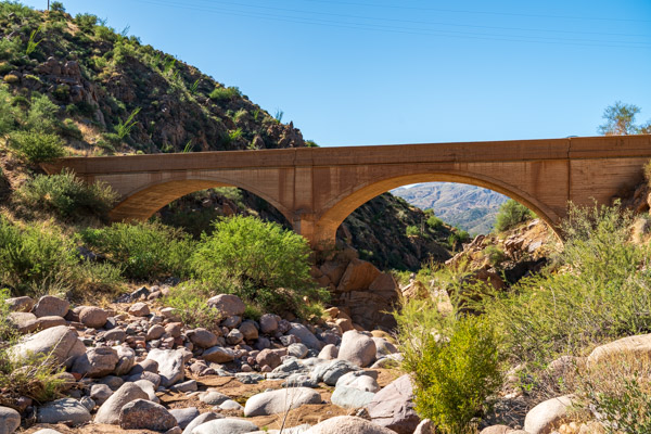
Dams and Reservoirs
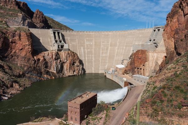
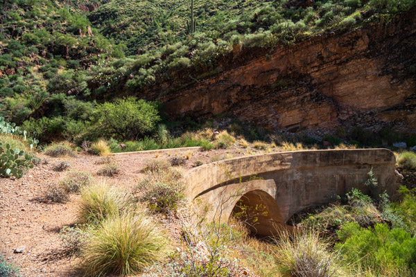
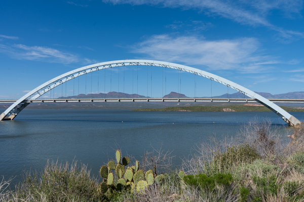
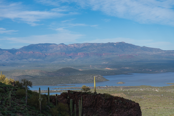
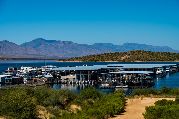
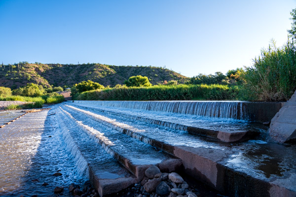
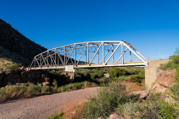
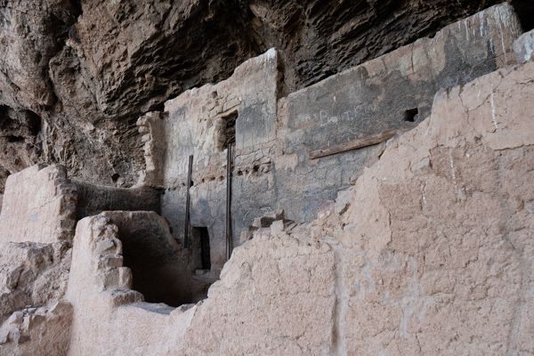
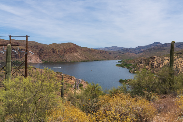
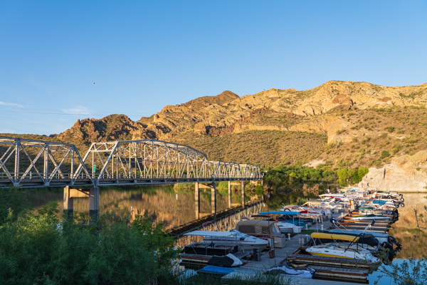
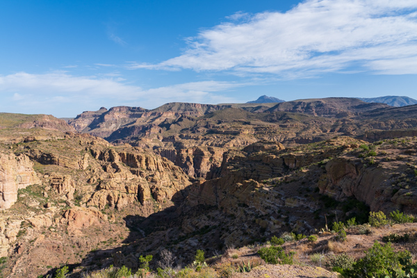
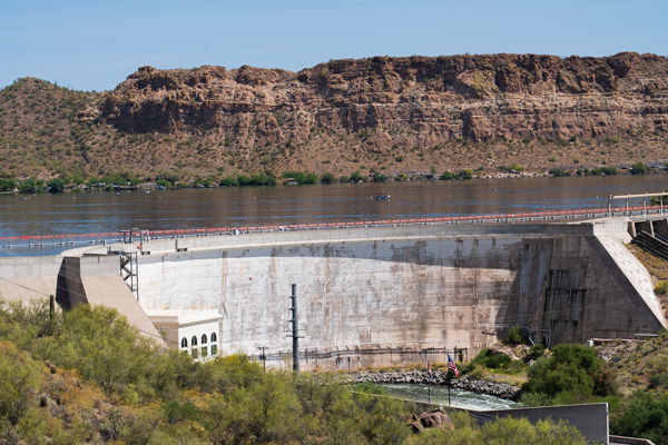
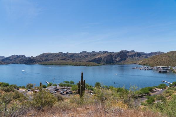
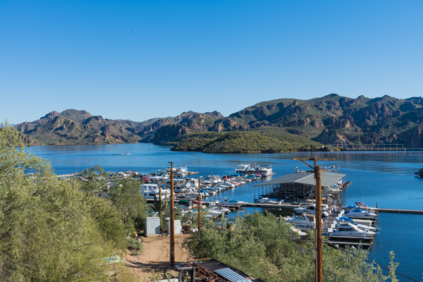
Constructed between 1905 and 1911, Roosevelt Dam was the first and largest of the dams built on the Salt River. After a major expansion and renovation that began in 1989, the dam now stands at 357 feet high and spans a length of 1,210 feet. It stores over 1.6 million acre-feet of water and generates 36 MW of electricity.Before Roosevelt Dam could even be built, a freight road from Mesa, Arizona to the dam site had to be constructed. The last bridge built on the freight road was at Alchesay Canyon, just below where the dam would eventually stand. The bridge still stands having withstood the years and the passage of millions of tons of construction materials. Although it is abandoned now, it is the last remaining vestige of the original haul road.Roosevelt Lake Bridge was constructed when Roosevelt Dam was expanded in 1989 to provide a way for automotive traffic to reach the other side of the Salt River. Spanning almost 2,000 feet, it is the longest two-lane, single-span, steel-arch bridge in North America.Roosevelt Lake as seen from the trail to the lower cliff dwellings at Tonto National MonumentRoosevelt Lake Marina is home to a number of boats and other watercraft. Boating and fishing are two of the popular activities on the lake, which is within Tonto National Forest.As part of the construction of Roosevelt Dam, a small hydroelectric power plant was constructed to power equipment and machinery. The hydroelectric plant’s turbines received water from a 19-mile long canal that was constructed upstream of the dam’s eventual location. Water was diverted into the power line canal via a diversion dam shown here. The hydroelectric plant, canal, and diversion dam have since been decommissioned but the diversion still stands, acting as a fish barrier today.The bridge over Arizona State Route 288 is just upstream of the takeout point for rafters exiting the Salt River Canyon Wilderness Area. Below the bridge is the power line canal diversion dam, above is the wilderness area.People of the Salado Culture occupied the upper Salt River from 1250 to 1450 CE. Shown here are a few of the 20 rooms in the Lower Cliff Dwellings at Tonto National Monument.Unlike Tonto National Monument, the inhabitants of Besh-Ba-Gowah did not construct their pueblo in a canyon cave but on the banks overlooking Pinal CreekApache Lake is formed by the Horse Mesa Dam. It lies about four miles downstream of Roosevelt Lake.The Apache Lake Marina is in poor condition as shown in this photo. Ever since a portion of the road from Canyon Lake to Apache Lake was closed as a result of erosion resulting from the Woodbury Fire, Apache Lake’s visitors have plummeted. The marina is in disrepair today.Pine Creek Bridge near Apache Lake was constructed as part of the realignment of the Apache Trail that was necessary when Horse Mesa Dam was built. The bridge dates from the mid-1920s. Though not as old as the bridge over Alchesay Canyon, Pine Creek Bridge is still in service.Canyon Lake is formed by the Mormon Flat Dam on the Salt River. It is the smallest of the four Salt River reservoirs, encompassing 950 surface acres.The Canyon Lake Marina provides boat moorings as well as RV and tent camping spaces.The scenic overlook at Fish Creek Hill provides a good view of Browns Peak in the Four Peaks Wilderness. Fish Creek Hill is only a few rugged air miles from both Canyon Lake and Apache Lake.Stewart Mountain Dam impounds the Salt River and forms Saguaro Lake about 40 miles northeast of Phoenix, Arizona. Saguaro Lake was the last of the reservoirs built on the Salt River and has a storage capacity of 69,565 acre-feet. The dam itself is 207 feet high and 1,260 feet long. It is capable of generating 13 MW of electricity.Saguaro Lake was the last of the reservoirs constructed on the Salt River and has a surface area of about 1,200 acres. The lake is surrounded by canyon walls which, as the name suggests, are covered with Saguaro cacti and other Sonoran Desert plants. The lake is popular with boaters and anglers.Shown here is the marina at Saguaro Lake.