A Visual and Verbal Narrative of Arizona's Salt River
Menu
Headwaters
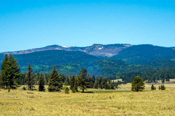
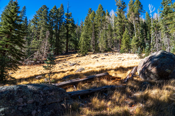
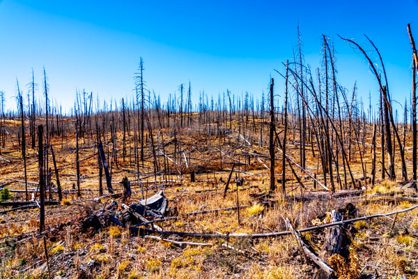
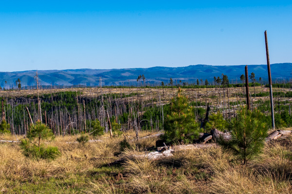
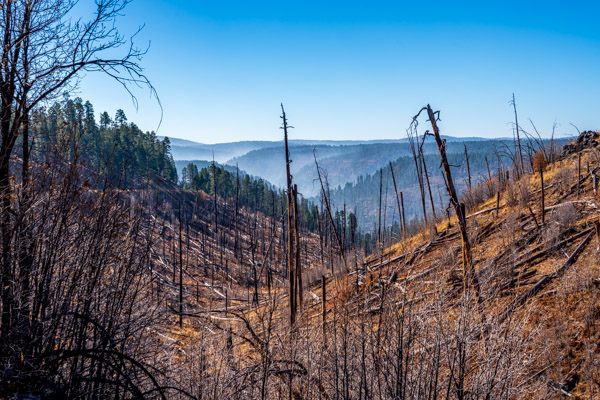
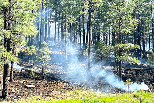
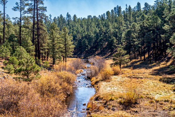
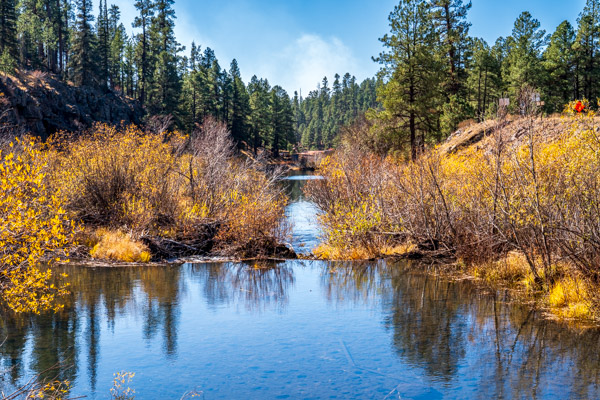
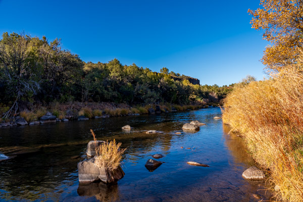
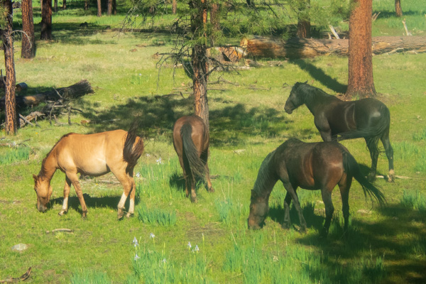
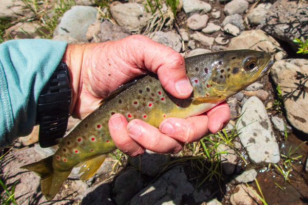
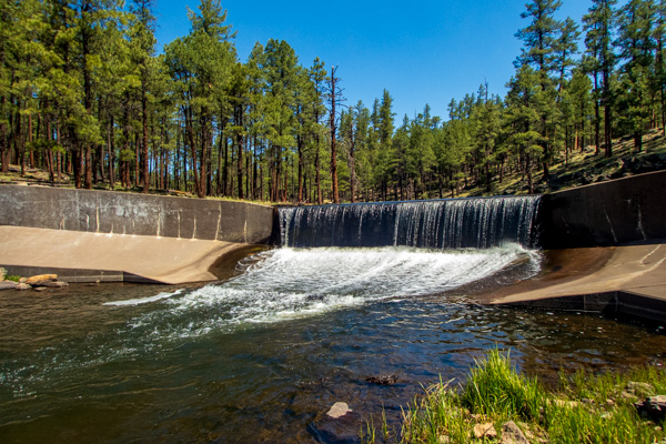
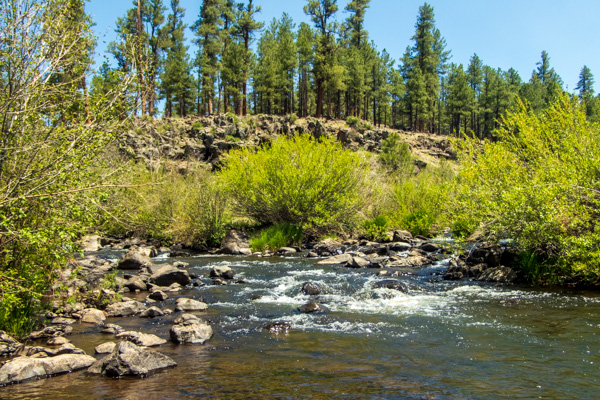
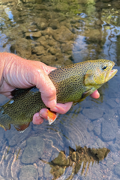
Mt. Baldy, elevation 11,400 feet, is the highest point in the White Mountains. The White Mountains are home to the White River as wells as the East and West Forks of the Black River, which are the headwaters of the Salt. Here Mt. Baldy is shown near Big LakeThe White Mountains experienced several periods of glaciation. The remains of these glaciers can be observed as glacial moraines as shown hereThe Wallow Fire was the largest wildfire in Arizona’s history. Here is the burn near Big Lake. The Wallow Fire had a major impact on the Black River watershed and consequently on the Salt River, tooThe extent of the burn on the West Fork of the Black River watershed is shown here near Big Lake. The burn extends across Home Creek, the West Fork of the Black, and the Hay Creek, all critical habitat for the Apache Trout.Smoke emanates from a fire burning in the upper Black River (remains of Wallow Fire in foreground). Fire is still a threat in the Salt River headwaters even after the Wallow FireA prescribed fire burns in the Apache-Sitgreaves National Forest near the West Fork of the Black River. Prescribed burns reduce the fuel in the forest and help to prevent fires like the Wallow Fire.The West Fork of the Black River flows down the White Mountains where it joins the East Fork and forms the Black RiverThe East Fork of the Black River meets the West Fork and together they form the Black River, a major tributary to the Salt. This picture shows two beaver dams in sequence.The White River is the other major tributary to the Salt (in addition to the Black River). It flows off the White Mountains, and is shown here near Fort Apache on the Fort Apache Indian ReservationFeral horses are a problem in Apache-Sitgreaves National Forest and the Forest Service is in the process of humanely capturing and removing them from the areaBrown trout like this one inhabit the West Fork and East Fork of the Black River. They compete with the native Apache Trout for resourcesA fish dam stretches across the West Fork of the Black River. It is designed to prevent non-native trout from moving upstream into Apache trout territoryThe West and East Forks of the Black River merge to form the Black River. In this image, the West Fork is coming in from the left, while the East Fork is coming in from the rightPicture of Apache trout being released after being caught on the fly. The Apache trout was listed as endangered in 1973 and subsequently moved to threatened status in 1975. Due to conservation efforts by federal, state, and tribal game and fish departments, however, it has made a remarkable comeback. In September 2024, the fish was officially removed from the list by the U.S. Department of the Interior.